


Természetjáró, a túratervező
Mô tả của Természetjáró, a túratervező
Hướng dẫn du lịch trực tuyến của Hungary, được phát triển đặc biệt dành cho người đi bộ đường dài, người đi xe đạp, người chạy đường mòn, người leo núi và những người yêu thích thể thao dưới nước, có công cụ lập kế hoạch du lịch tích hợp cũng như hàng trăm chuyến tham quan được đề xuất và hàng nghìn điểm tham quan, tất cả đều có mô tả chi tiết và nhiều hình ảnh , có thể xem thoải mái trên bản đồ tương tác. Có sẵn miễn phí, với tùy chọn đăng ký để có chức năng mở rộng.
Tính năng
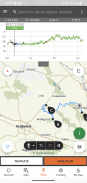
• Nhiều bản đồ đi bộ đường dài trên toàn thế giới có tính tương tác, có thể thu phóng, vector hóa với tất cả các đường mòn được đánh dấu, hiển thị vị trí hiện tại của bạn
• Một cách thuận tiện để lên kế hoạch cho chuyến tham quan của riêng bạn trên bản đồ và nhận được thông tin về độ dài, thời lượng và độ cao ngay lập tức
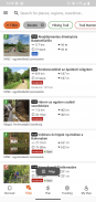
• Hơn một nghìn chuyến tham quan được đề xuất dành cho người đi bộ đường dài, người đi xe đạp, người chạy đường mòn và người chèo thuyền, với dữ liệu thực tế, mô tả chi tiết về các điểm tham quan đẹp nhất gần đó, nền tảng tự nhiên và văn hóa, ảnh chất lượng tốt và thông tin về cách đến đó
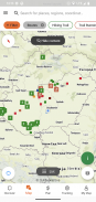
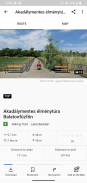
• Hàng nghìn điểm tham quan được đề xuất ở Hungary, bao gồm tháp quan sát, điểm toàn cảnh thiên nhiên, tàu đi rừng, pháo đài và bảo tàng, cùng với mô tả chi tiết, ảnh chất lượng tốt cùng với thông tin về cách đến đó
• Hàng trăm chỗ ở, bao gồm túp lều, khách sạn du lịch và căn hộ, gần những con đường mòn được đánh dấu
• Bộ sưu tập hữu ích với chế độ xem bản đồ: các bãi biển quanh hồ Balaton, sân trượt băng, vườn thực vật, các tuyến đường chạy bộ tốt nhất, địa điểm leo núi, các chuyến tham quan dành cho người khuyết tật, v.v.
• Thông báo, cảnh báo và đóng cửa
• Tải xuống các phần bản đồ, chuyến tham quan và điểm tham quan để sử dụng ngoại tuyến
• điều hướng nhanh chóng dọc theo tuyến đường với cấu hình độ cao trực tiếp và hướng dẫn bằng giọng nói
• Ghi lại lộ trình của bạn
• BuddyBeacon: chia sẻ quan điểm của bạn trực tiếp với bạn bè
• Chuyến Chuyến du lịch xanh Hungary hoàn chỉnh, với các chặng và tuyến đường chính thức, POI và chỗ ở
• Đồng bộ hóa tất cả nội dung của bạn giữa máy tính và thiết bị di động chạy ứng dụng
• Kiểm tra dự báo thời tiết tại địa phương
• Chuyến bay 3D: cái nhìn toàn cảnh ảo về chuyến tham quan
• Các công cụ hữu ích được tích hợp sẵn, chẳng hạn như công cụ tìm đỉnh(Skyline) và la bàn với vị trí hiện tại của bạn
• Dịch vụ cộng đồng: xếp hạng và chia sẻ nội dung với bạn bè
Đồng hồ thông minh chạy hệ điều hành WEAR của Google
Chỉ cần nhìn vào Đồng hồ thông minh, bạn sẽ nhận được thông tin về vị trí GPS của mình trên bản đồ. Bạn có thể ghi lại các tuyến đường, nhận dữ liệu theo dõi và điều hướng dọc theo các tuyến đường. Sử dụng ô ứng dụng để dễ dàng truy cập các tuyến đường lân cận.
Dành riêng cho thành viên Pro
Đi mọi nơi: Outdooractive Pro hoạt động ngoại tuyến mà không cần tín hiệu dữ liệu và di động. Danh sách không giới hạn cũng có thể được tạo và ứng dụng không có quảng cáo. Ngoài ra, bạn có thể xem hình ảnh vệ tinh, bản đồ Hoạt động ngoài trời độc đáo với hơn 30 mạng lưới đường mòn hoạt động và bản đồ địa hình chính thức từ các nhà cung cấp sau:
Khảo sát quân sự của Vương quốc Anh, Landranger, Explorer
Thông tin đất đai New Zealand
USGS Utah
Đức BKG
Áo BEV
Thụy Sĩ Swissstopo
Pháp IGN
CNIG Tây Ban Nha
Nước Ý
Hà Lan PDOK
Kartverket Na Uy
Đan MạchKortforsyningen
Thụy ĐiểnLantmäteriet
Khảo sát đất đai quốc gia Phần Lan
GSI Nhật Bản
Bản đồ toàn cầu
Dành riêng cho thành viên Pro+
Pro+ cũng chứa các bản đồ chính thức từ Hiệp hội Alpine cũng như các bản đồ cao cấp từ KOMPASS.
Nếu bạn có thắc mắc hoặc đề xuất, vui lòng truy cập
https://www.termeszetjaro.hu/hu/p/gyakran-ismetelt-kerdesek/41050512 /
Phiên bản dành cho máy tính để bàn của chúng tôi:
https://www.termeszetjaro.hu/
Theo dõi chúng tôi trên Facebook:
https://www.facebook.com/Termeszetjaro.hu/
Liên hệ với chúng tôi:
termeszetjaro@termeszetjaro.hu
Thông tin thêm về thẻ TEKA:
http://www.termeszetjarokartya.hu/
Természetjáró, a túratervező - Thông tin APK
Phiên bản APK: 3.19.4Gói: com.outdooractive.mtszPhiên bản mới nhất của Természetjáró, a túratervező
Phiên bản khác


Ứng dụng cùng danh mục

Bạn cũng có thể thích...


